9 Best Hikes in the Canadian Rockies
Discover the best hikes in the Canadian Rockies with this expert guide. From beginner-friendly trails to epic multi-day adventures, find your perfect mountain escape with detailed tips, safety advice, and insider knowledge.
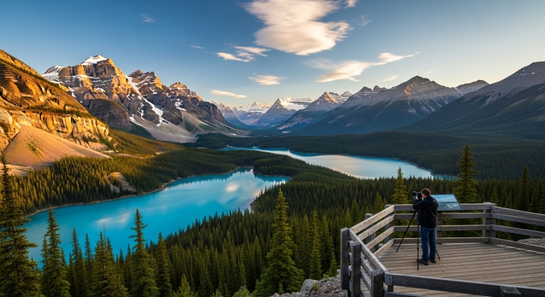
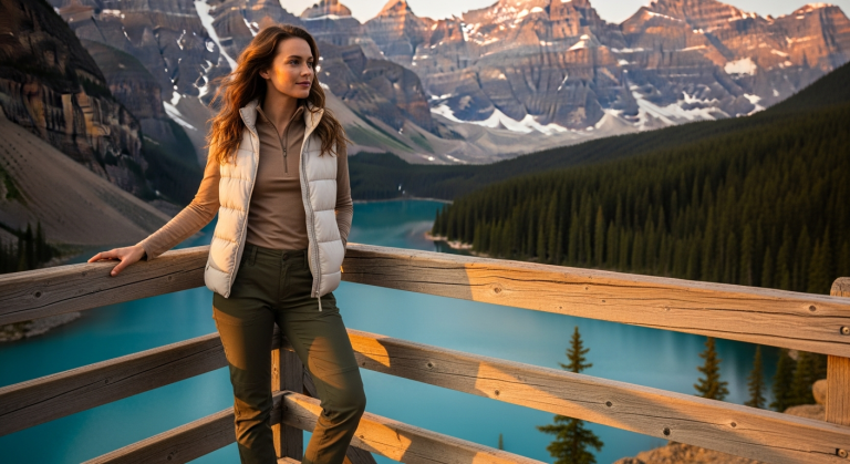
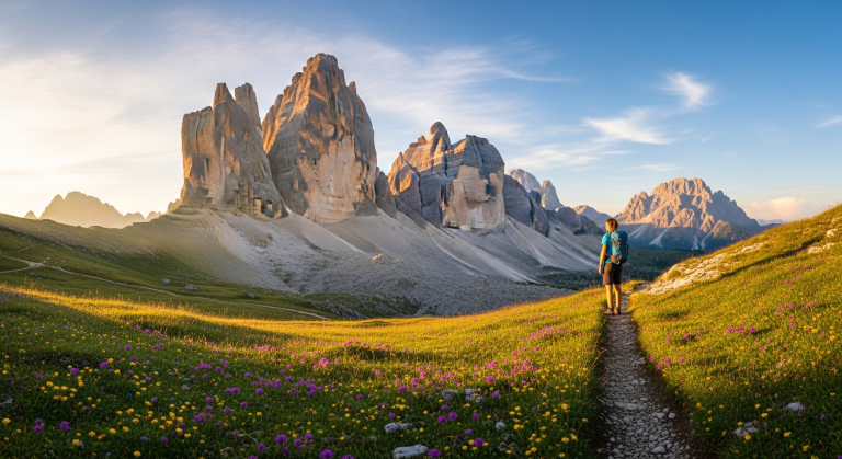
Maybe you have been dreaming of standing at a turquoise alpine lake, surrounded by jagged peaks that pierce the sky, with wildflowers dancing at your feet and the only sound being the whisper of wind through ancient pines. This isn’t a dream—it’s just another day hiking in the Canadian Rockies.
I’ll never forget my first morning on the Plain of Six Glaciers trail. I left the Lake Louise parking lot in pre-dawn darkness, headlamp bobbing along the shoreline, questioning my sanity.
Then the sun crested the mountains, and suddenly everything was bathed in gold. The Victoria Glacier glowed pink. Steam rose from the lake. A family of elk grazed fifty feet away, completely unbothered by my presence.
That’s when I understood why people travel from every corner of the globe to hike these mountains.
But here’s the thing—planning your first Rockies hiking adventure can feel overwhelming. Which trails deliver those jaw-dropping views? Where do beginners start? What gear do you actually need versus what the internet tells you to buy? And how do you stay safe in genuine wilderness where grizzlies outnumber people?
I’ve spent seven summers exploring these trails, from family-friendly strolls to grueling multi-day backcountry treks. I’ve made mistakes (hello, cotton t-shirt in a rainstorm), learned from locals, and discovered which hikes truly deliver unforgettable experiences. This guide cuts through the noise and gives you exactly what you need to plan your perfect Canadian Rockies hiking adventure.
What Makes the Canadian Rockies a Hiker’s Paradise

Unmatched Natural Beauty and Diversity
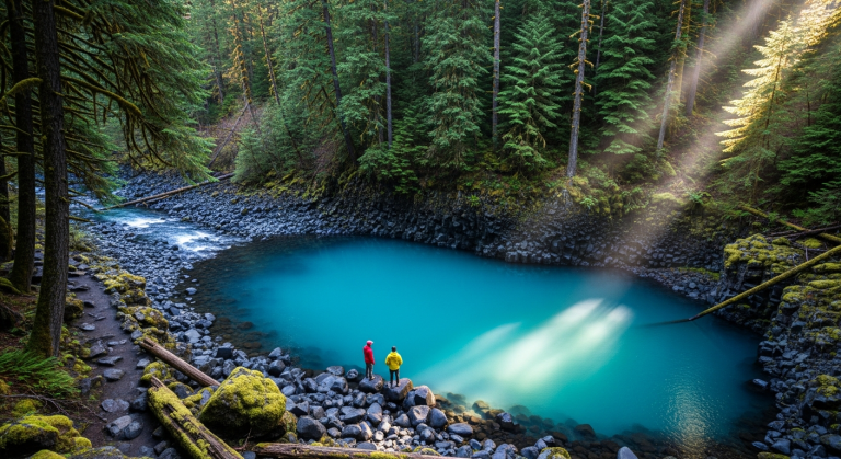
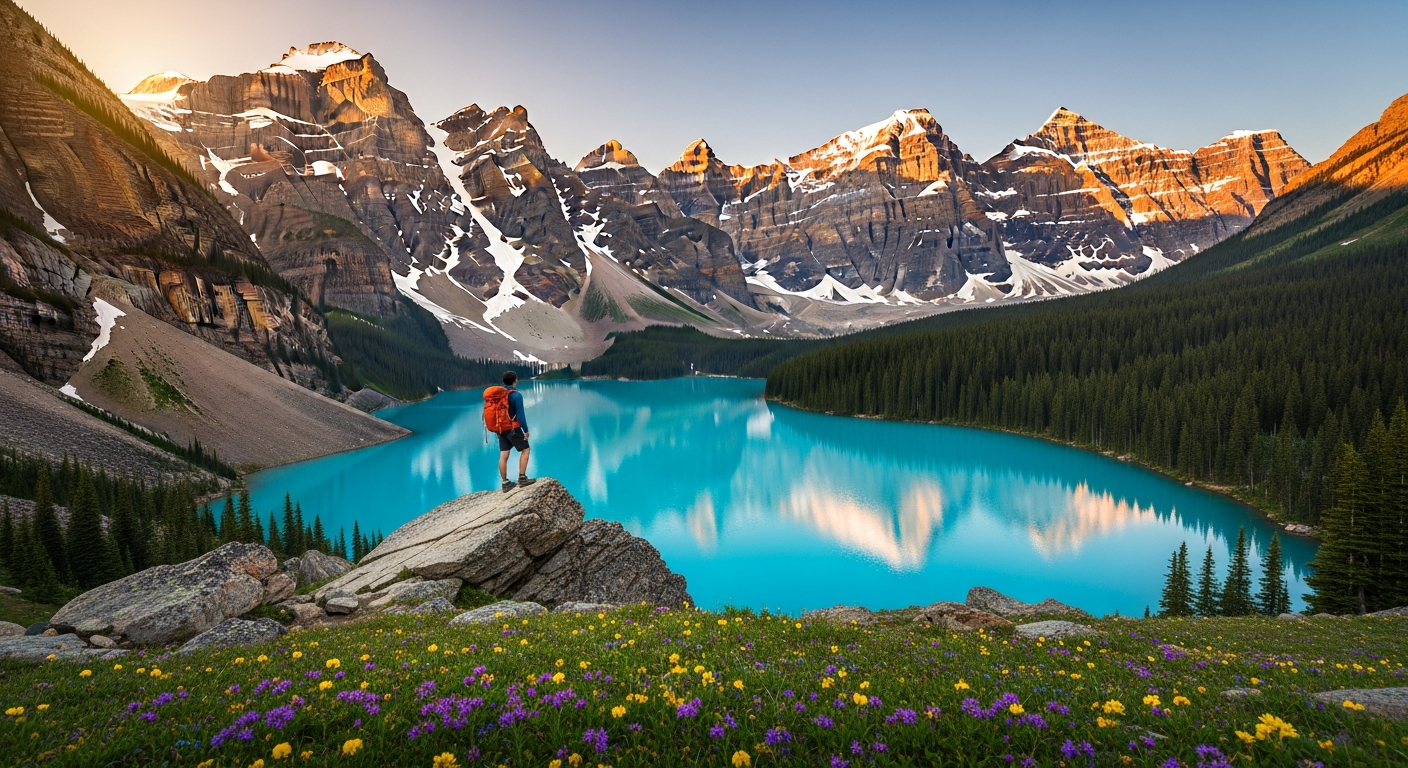
The Canadian Rockies don’t just offer scenic views—they deliver landscapes so stunning they seem photoshopped. Those impossibly turquoise lakes? That’s glacial flour suspended in the water, created by glaciers grinding rock into fine powder. Lake Louise and Moraine Lake are famous for a reason, but dozens of equally breathtaking alpine lakes hide along backcountry trails.
The wildlife encounters alone make every hike an adventure. I’ve watched bighorn sheep navigate cliff faces that would make a rock climber weep. I’ve spotted mountain goats perched on ledges barely wider than my hand. And yes, I’ve had my heart stop when a grizzly emerged from the treeline (we’ll talk bear safety later—it’s non-negotiable knowledge).
The seasonal transformations turn these mountains into a year-round spectacle. July brings wildflower meadows that explode in purple, yellow, and pink. August offers perfect hiking weather and crystal-clear visibility. September transforms larch forests into golden cathedrals that glow like fire when the sun hits them right. Each season rewrites the landscape completely.
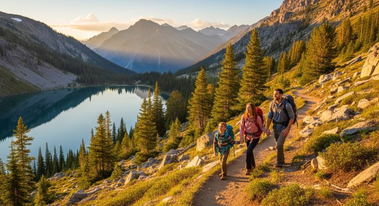
Trails for Every Experience Level
Here’s what most hiking guides won’t tell you: the Canadian Rockies are genuinely accessible to everyone, not just hardcore mountaineers with technical skills. The Parks Canada system maintains hundreds of trails with clear signage, regular maintenance, and detailed information available at visitor centers.
Never hiked before? Start with Johnston Canyon’s catwalk system—it’s practically a scenic stroll with waterfalls. Ready for more challenge? The Plain of Six Glaciers delivers glacier views without requiring crampons or climbing experience. Want to test your limits? The Rockwall Trail will humble even experienced backpackers.
The trail network spans four major national parks—Banff, Jasper, Yoho, and Kootenay—plus numerous provincial parks. You could spend an entire summer here and barely scratch the surface. That’s not marketing hype. That’s just geography.
Accessibility and Infrastructure
Unlike remote wilderness areas that require bush planes or multi-day approaches, most Canadian Rockies trails sit within two hours of major airports. Calgary International Airport puts you ninety minutes from Banff. Edmonton gets you to Jasper in under four hours.
The infrastructure here spoils you. Visitor centers stock detailed trail maps and provide current conditions. Parks Canada staff actually know the trails—they’ll tell you which ones are muddy, where recent bear sightings occurred, and which parking lots fill by 7 AM.
During peak season (July-August), shuttle services run to popular trailheads like Moraine Lake, solving the parking nightmare that used to plague these destinations. Book your shuttle reservation when you book your accommodation—they sell out weeks in advance.
Best Beginner-Friendly Hikes in the Canadian Rockies

Lake Agnes Tea House Trail (Banff National Park)
Distance: 7 km round trip Elevation gain: 400m Time: 2.5-3.5 hours
This trail proves that beginner-friendly doesn’t mean boring. You’ll climb gradual switchbacks through subalpine forest, catch your first glimpse of Mirror Lake (a perfect rest stop), then continue to Lake Agnes, where a century-old tea house serves fresh-baked goods and hot drinks at 2,135 meters elevation.
The tea house opens early June through early October, weather permitting. Yes, they literally hike in supplies and bake everything on-site. Yes, the homemade soup and sandwiches taste better than anything you’ve ever eaten, though that might be the altitude and accomplishment talking.
Pro tip: The parking lot at Lake Louise fills by 6:30 AM in summer. Arrive before 6 AM or take the Parks Canada shuttle. I learned this the hard way after circling for forty minutes and nearly giving up. Starting early also means you’ll reach the tea house before the midday crowds and might spot wildlife along the trail.
Johnston Canyon (Banff National Park)
Distance: 5.4 km to Upper Falls Elevation gain: 215m Time: 2-3 hours
Johnston Canyon feels like nature’s theme park—in the best possible way. Steel catwalks cling to canyon walls, taking you through a limestone gorge carved by thousands of years of rushing water. The Lower Falls appear after just 1.1 km, making this perfect for families with young kids who need quick rewards.
But here’s the secret: most people stop at Lower Falls. Continue to Upper Falls, and the crowds thin dramatically. The 30-meter waterfall thunders into a turquoise pool, and the spray creates rainbows on sunny afternoons.
The catwalks make this trail accessible year-round. Winter transforms the waterfalls into frozen sculptures, and ice cleats turn this into a magical cold-weather adventure. Just know that “beginner-friendly” changes definition when ice is involved.
Insider knowledge: Visit after 6 PM in summer. The late-evening light is gorgeous, most tourists have left, and you’ll actually hear the water over the crowd noise. The trail is lit until 10 PM during peak season.
Maligne Canyon (Jasper National Park)
Distance: 4 km loop Elevation gain: Minimal Time: 1.5-2 hours
Maligne Canyon delivers maximum scenery with minimum effort. This 50-meter-deep limestone gorge features six bridges that span increasingly dramatic sections of canyon. Bridge One shows you impressive depth. By Bridge Six, you’re staring into a narrow chasm where water has carved intricate patterns into ancient rock.
The loop trail lets you start at either end. Beginning at Bridge One means you descend gradually into the canyon—easier on the knees and building anticipation. Starting at Bridge Six reverses this but gives you the “wow” factor immediately.
Best for: This trail works for almost everyone. I’ve seen people in wheelchairs navigate portions of it. Families with strollers handle the upper bridges easily. The minimal elevation gain means you’re not gasping for air while trying to enjoy the views.
The canyon is genuinely stunning in winter when waterfalls freeze into columns and caves form in the ice. Guided ice walks take you into the canyon itself—an experience that tops many people’s Rockies bucket list.
Epic Intermediate Hikes for Adventurous Explorers

Plain of Six Glaciers (Banff National Park)
Distance: 14 km round trip Elevation gain: 365m Time: 4-6 hours
This trail transformed my understanding of what “accessible glacier views” means. You start along Lake Louise’s shoreline, already stunning, then climb gradually through forest until you emerge onto a rocky plain. Suddenly, six glaciers surround you—Victoria, Lefroy, Upper Lefroy, Aberdeen, Lower Victoria, and Pope’s—massive rivers of ice that have carved these mountains for millennia.
The historic tea house at kilometer 5.7 serves as a perfect turnaround point for those wanting a shorter day. But push another 1.4 km to the end of the maintained trail, and you’ll stand so close to Victoria Glacier you can hear it cracking and groaning as it moves.
When to go: July through September offers the most reliable conditions. I hiked this in late June once, and snow still covered portions of the upper trail. Early September delivers cooler temperatures and smaller crowds, though the tea house closes around mid-September.
Safety note: This is active grizzly territory. I’m not exaggerating for dramatic effect—Parks Canada posts current bear activity at the trailhead. Carry bear spray. Make noise on blind corners. Travel in groups of four or more when possible. I’ve encountered bears twice on this trail, and both times, proper precautions kept everyone safe.
Sentinel Pass via Larch Valley (Banff National Park)
Distance: 11.6 km round trip Elevation gain: 725m Time: 5-7 hours
If you hike only one trail in the Canadian Rockies during September, make it this one. The larch trees in Larch Valley turn golden for approximately two weeks, creating a scene so spectacular it borders on unreal. The entire valley glows. Against the backdrop of Pinnacle Mountain and Mount Temple, it’s the kind of view that makes you understand why people quit their jobs to chase moments like this.
The trail starts from Moraine Lake (shuttle required in summer) and climbs steadily through forest before opening into Larch Valley. Most hikers stop here, snap photos, and head back. Don’t be most hikers. The final push to Sentinel Pass—steep, rocky, and absolutely worth the burning quads—reveals a panoramic view that includes the Valley of the Ten Peaks, Paradise Valley, and endless mountain ranges stretching to the horizon.
Challenge level: That final ascent to the pass is no joke. You gain 300 meters in less than a kilometer. My lungs were screaming. My legs threatened mutiny. Then I reached the top, and suddenly none of that mattered.
Wildflower bonus: If you can’t make it in September, late July through early August transforms the valley into a wildflower paradise. Purple lupines, yellow glacier lilies, and red Indian paintbrush carpet the meadows.
Wilcox Pass (Jasper National Park)
Distance: 8 km round trip Elevation gain: 335m Time: 3-4 hours
Here’s the trail that locals recommend instead of the crowded Columbia Icefield Skywalk. You get better views of Athabasca Glacier, you actually exercise instead of standing on a glass platform, and you’ll likely encounter bighorn sheep that treat this area as their personal territory.
The trail climbs through subalpine forest before breaking into open alpine meadows. The Athabasca Glacier sprawls below you, part of the massive Columbia Icefield. On clear days, you can see how dramatically the glacier has receded—markers show where it reached in previous decades, a sobering reminder of climate change’s impact.
Wild highlights: I’ve never hiked Wilcox Pass without seeing bighorn sheep. They graze in the meadows, completely unfazed by hikers. Keep your distance (30 meters minimum), but bring a zoom lens or binoculars. During rutting season (late November), rams clash horns in battles that echo across the valley.
The trail continues beyond the main viewpoint for those wanting more mileage. The ridge walk offers 360-degree views and solitude—most people turn around once they’ve photographed the glacier.
Lake O’Hara Alpine Circuit (Yoho National Park)
Distance: 12 km loop Elevation gain: 495m Time: 5-7 hours
Lake O’Hara requires more planning than any other hike in this guide, and it’s absolutely worth the effort. Parks Canada limits access via a bus reservation system that opens in April for summer dates. Spots sell out within minutes. Set multiple alarms. Have backup computers ready. Treat it like concert tickets for your favorite band.
Why the fuss? Lake O’Hara represents the Canadian Rockies at their most pristine. The alpine circuit connects multiple lakes—Oesa, Opabin, McArthur—each more stunning than the last. The trails are immaculate. The scenery is breathtaking. And because access is limited, you won’t fight crowds for photo spots.
The circuit can be hiked in either direction. Counterclockwise hits Lake Oesa first—a steep climb that gets your heart pumping but rewards you with turquoise water surrounded by towering peaks. Clockwise saves Oesa for last, when you’re tired but the downhill return feels easier.
Why it’s worth the effort: I’ve hiked throughout the Rockies, and Lake O’Hara still stands out. The limited access preserves an experience that’s increasingly rare—wilderness that feels genuinely wild, where nature dictates the pace instead of tourism infrastructure.
Challenging Multi-Day Adventures for Serious Hikers

Berg Lake Trail (Mount Robson Provincial Park)
Distance: 46 km round trip Elevation gain: 795m Time: 3-4 days
Mount Robson—the highest peak in the Canadian Rockies at 3,954 meters—dominates the skyline from the moment you start this trail. The Berg Lake Trail takes you to its base, where icebergs (hence “Berg”) calve from the glacier and float in impossibly blue water.
The trail follows the Robson River through ancient cedar forests, past thundering waterfalls (Whitehorn Falls and Emperor Falls are worth long photo stops), and into alpine meadows before reaching Berg Lake. Each of the seven campgrounds along the route offers different perspectives, but Berg Lake campground delivers the ultimate reward—falling asleep to the sound of glaciers calving.
What to expect: That calving sound is wild. It starts as a crack, like thunder echoing off the mountains. Then comes the crash as house-sized chunks of ice break free and plunge into the lake. It happens multiple times per night during warm weather. I spent three nights at Berg Lake and never got used to it—in the best way possible.
Permit requirements: BC Parks manages reservations through a lottery system that opens in January for summer dates. Competition is fierce but not as insane as Lake O’Hara. Apply early, be flexible with dates, and have backup plans.
The trail is well-maintained and clearly marked, but weather can turn severe quickly. I’ve experienced snow in July, 30°C heat in August, and horizontal rain that made me question my life choices. Pack for all conditions.
Skoki Valley Loop (Banff National Park)
Distance: 35 km loop Elevation gain: 775m Time: 2-3 days
Skoki Valley feels like stepping back in time. The historic Skoki Lodge, built in 1930, was Canada’s first backcountry lodge and still operates today (reservations required months ahead). You can stay at the lodge for a rustic-luxe experience—beds, meals, no electricity—or camp at designated sites and cook your own meals.
The loop can start from either Fish Creek or Lake Louise ski area. I prefer the Fish Creek approach—it’s longer but more scenic, with views of Ptarmigan Lake and the Skoki Valley spread below you like a landscape painting.
Scenery: Multiple alpine lakes dot the valley. Merlin Meadows explodes with wildflowers in late July. The surrounding peaks—Ptarmigan Peak, Mount Richardson, Fossil Mountain—create a dramatic amphitheater that changes mood with the light.
Best season: Late July through September offers the most reliable weather and snow-free trails. The lodge operates June through September, but early season can mean snow on the passes.
This trail doesn’t require technical skills, but it demands endurance and navigation ability. The route crosses several passes, and weather can obscure trail markers. Carry detailed maps and know how to use them.
Rockwall Trail (Kootenay National Park)
Distance: 55 km one-way Elevation gain: Cumulative 1,400m Time: 4-5 days
The Rockwall Trail is where you go when you want genuine wilderness immersion without the crowds that plague Banff’s popular routes. This trail follows the base of the Rockwall—a 900-meter limestone cliff that stretches for more than 30 kilometers—through some of the most remote terrain in the Canadian Rockies.
You’ll cross four passes, each offering different perspectives on the Rockwall’s massive face. Tumbling Glacier hangs above Tumbling Pass, and watching ice fall from it drives home how small you are in this landscape. Wolverine Pass provides views into the Wolverine Valley, where I spotted a grizzly digging for roots about 400 meters away.
Epic feature: The Rockwall itself is geology on a scale that’s hard to comprehend. It’s ancient seabed thrust upward and tilted vertical by the forces that created these mountains. Fossils are embedded in the rock face—remnants of marine life from when this area sat at the bottom of an ocean.
Backcountry experience: You’ll see far fewer hikers here than on Banff’s trails. The campgrounds are smaller, more primitive, and spaced for serious daily mileage. Cell service doesn’t exist. You’re genuinely off-grid, relying on your skills and preparation.
The trail requires a shuttle between trailheads unless you arrange a car drop. Most hikers start at Floe Lake trailhead and finish at Paint Pots, which offers slightly more downhill overall.
Essential Gear and What to Pack for Canadian Rockies Hikes

The Must-Have Basics (Even for Short Hikes)
The Ten Essentials aren’t suggestions in the Canadian Rockies—they’re requirements. I learned this when a “quick afternoon hike” turned into a six-hour ordeal after I took a wrong turn in deteriorating weather. The gear in my pack made the difference between an adventure story and a rescue situation.
Navigation: Download offline maps to your phone using AllTrails or Gaia GPS. Cell service is unreliable at best. Carry a physical map and compass as backup. Know how to use them before you need them.
Sun protection: High altitude means intense UV radiation. I’ve gotten sunburned through clouds at 2,500 meters. Pack SPF 50+ sunscreen, lip balm with SPF, and sunglasses. Reapply every two hours.
Extra layers: Mountain weather changes faster than you can react. I’ve started hikes in t-shirts and finished in full rain gear with gloves. Pack an insulating layer (fleece or down jacket) and a waterproof shell, even if the forecast looks perfect.
First aid kit: Include blister treatment—moleskin or leukotape saves hikes. Add pain relievers, antihistamines for bee stings, and tensor bandages for sprains. I carry a small tick removal tool after finding one embedded in my leg after a meadow hike.
Bear spray: This is non-negotiable.